-2.png)
Today's article on Spatial Analysis concludes our blog series on our toolkit.
Spatial analysis describes processes of modeling problems geographically, deriving results through computer processing, and then examining and verifying those results. This type of analysis has proven to be extremely effective in determining the geographic suitability of specific locations for the purposes at hand, estimating and predicting outcomes. It also allows changes to be interpreted and understood or important patterns to be detected that provide further information.
Spatial analysis is composed of several components:
Spatial Analysis
- Spatial Explainability
- Spatial Clustering
- Spatial Modeling
- Regression
- Classification
- Pattern Recognition
In the following, we will look at the individual components of spatial analysis.
Spatial Explainability
With Machine Learning, it is not immediately obvious to human users why the model has made a certain decision. The process is no longer based solely on human-made codes, but evolves from the data itself. This makes it harder to understand the outcome. Explainability means making the decision tangible to humans. In this step, we describe the influence that the defined features have.
For example, we trained a model that predicts rental prices. The users are primarily interested in the results. However, they also want to know how the calculated rents come about. Spatial Explainability looks at the features that are relevant for the model to predict prices. So if characteristic X is present in characteristic Y, the price will be high or low.
- The closer the apartment is to a landfill, the lower its price.
- The closer the apartment is to the city center, the higher its price.
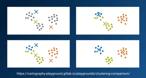
Spatial Clustering
Clustering describes the process of grouping data or objects into groups called "clusters." The contents within the clusters are very similar, whereas the different clusters should have as little in common as possible. This allows generalizing statements to be made and connections to be discovered. Spatial clustering involves looking for spatial commonalities and creating clusters accordingly. For example, a cluster could include buildings that were built before 1970 and have a heat demand greater than 40,000 kWh per year.
Spatial Modeling
- Regression
The goal in a regression analysis is to use an independent variable to explain a dependent variable. Regression (and prediction in general) helps us explore how spatial structures can help us analyze and understand our data. A regression is the prediction of a continuous value such as the expected utilization of an electric charging station.
- Classification
Classification is about determining classes. Classifications relevant to us are, for example:
The street section is well or poorly suited for expanding the district heating network there.
The location is well or poorly suited for installing a new charging station. - Pattern Recognition
Pattern Recognition means the automatic recognition of patterns and regularities in data. It is used in statistical data and image analysis, bioinformatics, computer graphics and machine learning. Pattern recognition has its origins in statistics and engineering. Some modern approaches to pattern recognition include the use of machine learning, made possible by the increasing availability of data and increased computing power. Our analysis for charging infrastructure, for example, examines which patterns ensure that a charging station has a high utilization rate.
If you want to dig deeper into Geo Data Science, check out the webinar by our co-founders and CTO Niclas Goby:


